
India News
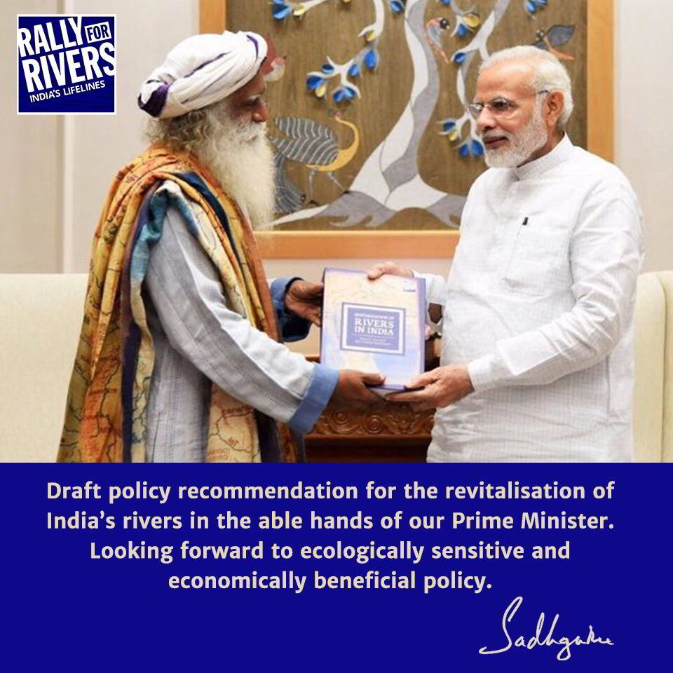
Sadhguru’s Draft Policy for River Revitalisation: plant trees along river sides
By Rashme Sehgal
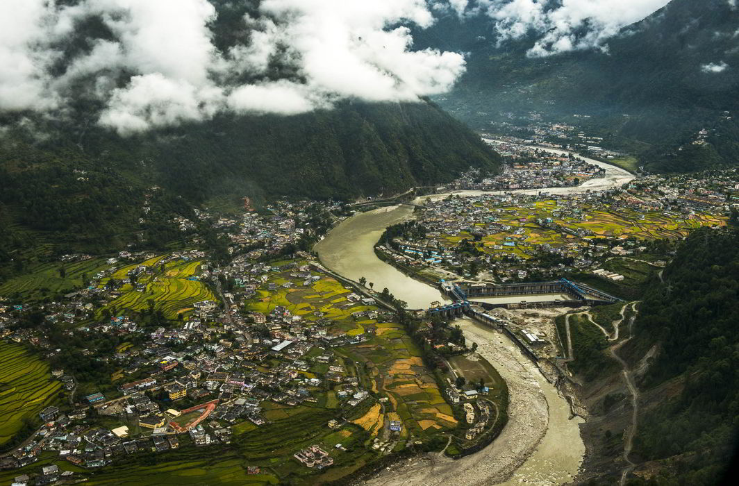
Sadhguru Jaggi Vasudev’s recently concluded ‘Rally for Rivers’ is an attempt to come up with a comprehensive plan to rejuvenate our rivers. He criss-crossed across sixteen states in an attempt to build up a mass movement to help farmers and state governments get involved in tree plantation as being one key areas through which river rejuvenation can take place.
For the first time, he elaborates on the draft policy presented to the Ministry of Water Resources on what steps need to be taken for river revitalization.
Q. What does your draft policy on River Revitalization focus on?
A. The draft policy for river revitalization focuses on the health and life of the river as a living entity. It proposes tree plantation along the river sides as a means for “source augmentation”.
Q. What does source augmentation mean?
A. It means an overall increase in the actual quantum of water in the river.
Q. What does the policy of giving missed calls indicate and why was so much focus given on this? Was it an attempt to create a wider participation base?
A. If we aggressively implement this policy, it will take anywhere between 15-25 years to get a 15-20% rise in the river flows. This means four to five governments would have come and gone by the natural democratic process. How do we keep these five governments in the next twenty-five years focused on one policy? This is why the missed call. If a large part of the electorate votes for it, no government is going to ignore it. Not just this government, but whoever comes to power in the next twenty-five years. It will be in all of their minds that the entire nation wants this long-term policy for the well-being of our rivers.
Q. You have been quoted as suggesting we have 20,000 km of riverine land which can be used for river-based agriculture. Does this land include the flood plains of our rivers which are inviolate because this land is where our rivers are allowed to regenerate themselves and which are being violated by systematic encroachments?
A. The length of all major rivers put together makes up around 20,000 km. The land that we are proposing to implement the solution is laterally 1 km on either sides of the river. So if the solution were to be implemented for all the large rivers from their origin to the estuaries where they meet the seas it will be 40,000 sq km. The solution of transitioning from regular farming to tree-based agriculture is only in the privately owned farm lands. On government owned lands and the land that belongs to the river, appropriate native and endemic vegetation will be planted, ranging from trees, shrubs and grasses based on scientific studies. But to begin with, we are suggesting tree plantation at a 1 km distance to exhibit the results of the solution we propose, especially the effects of tree-based farming for farmers.
We are not asking for resettlement or removal of already existing villages or other establishments in this region. We are only suggesting a change in cultivation pattern in the target area from field crops to tree-based crops. This suggestion is based on observed improvement in our farmer’s income when shifted from field-based crops to tree-based crops. We at Isha have been working with a group of 1000 farmers, and some of them have transitioned to tree-based farming and realized better incomes. To begin with, we are suggesting that governments demonstrate this model initially in a continuous 100 km stretch to see its impact. Once this model has its impact on the river and farmers’ livelihood, it will have the acceptance and willingness of farmers and hence may expand organically in a few years’ time.
Planting trees on riversides have varied impact on the river and the soil in the area. Trees are known to improve inland rainfall by seeding the clouds from their evapotranspiration, pollen and other material, curtail soil erosion during floods, stabilize microclimate and improve the groundwater levels.
Q. What are the comprehensive steps you have outlined for river rejuvenation?
A. The overall solution proposed in the policy recommendation document submitted to the government contains details include developing tree cover by planting trees on a minimum of one kilometre width on either side of the river along the entire river’s length.
For government owned riverside lands and river banks, we recommend plantation of native and endemic trees along with appropriate native shrub land and wetland varieties. This plantation need not be restricted to the 1 km recommendation and can extend beyond these boundaries.
 In the case of private land, planting of horticulture and multi-purpose tree plantation by farmers and other citizens is suggested. The width of agro-forestry in farm lands is suggested to be as many villages that fall on the minimum of one-kilometre lateral distance from the river, as a whole.
The policy recommendations we suggest are towards making these proposed solutions happen. They are broadly classified into specific aspects that are directly related to: revitalization of river flow; engaging and involving all the communities that will be affected by the policy changes; de-risking all the farmers who are the majority stakeholders in this project, in target areas when they transition from one type of farming to another; and coordinated institutional functioning of government ministries and departments.
In the detailed approach for implementation we detail how the proposed 1 km tree-based farming for farm land and afforestation of entire government land beside rivers can be implemented. The implementation plan details our economics of tree farming for farmers, the forward and backward linkages required to make the economics happen, the roles and responsibilities of all the stakeholders – the farmers, industries, government and the larger nation as consumers of tree-based produce. Along with these the document also covers the scientific basis for the proposed solution.
Q. We have experts like physicist Prof Vikram Soni and water man Rajendra Singh and many others who have emphasised a policy to end encroachments on our river flood plains. Just doing this will allow rivers to regain their flow and allow them to rejuvenate themselves especially during the monsoon months. What do you feel about this?
A. We can suggest prospectively what can happen on the floodplains, but we cannot suggest retrospectively to evict existing settlements. Having the floodplains for rivers themselves would have been great, but the reality is, it is not the case. We have to work within the constraints of the existing land use pattern. We can have restrictive and prohibitive regulations for prospective use of the floodplains. For this to happen we need to first establish the boundaries of what land belongs to the river. Right now we don’t have such a mapping. Even if we were to find that some of the land that belongs to river is being used by farmers, we can only suggest changes in the farmer’s existing land use patterns to move from field crops to tree-based farming.
Q. River interlinking has not worked anywhere in the world? What do you feel about this especially since our government is going ahead with it?
A. Interlinking of rivers is based on the assumption that some river basins have “surplus” water supply while others have a “deficit”, and by linking them, water supply can be more evenly distributed. However, from our interaction with a few scientists, we got to know that paradigm of “surplus” and “deficit” basins is a limited understanding and does not take into consideration varying climatic conditions. For instance, it is observed that the monsoons have weakened since the 1950s in various parts of India and rainfall in parts of the country is now happening for fewer days and often in very intense spells. The “surplus” basins may, in fact, face water stress due to this variation in rainfall.
A few interlinking projects have already rolled out. It would be ideal if we evaluate the economic gains from these projects and weigh them against the loss of natural resource capital, before embarking on new projects. Any new proposal for interlinking must strictly be evaluated on the basis of scientific and environmental merit and long-term sustainability, rather than on the basis of emotions and politics. And while assessing potential benefits, in the context of our tropical climate, we should account for the resultant loss of water via evaporation and ground seepage. In India, rivers are mostly forest-fed; therefore, bringing back the tree cover on either sides of the river is the only long-term sustainable solution to address water scarcity and reduce the impact of floods and droughts.


India News
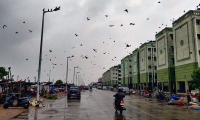
Late-March western disturbance brings 1,000-km rain band across India, Pakistan and Afghanistan
An unusual western disturbance has created a 1,000-km rain band, bringing widespread storms, rainfall and hail across parts of India and neighbouring countries.
India News
Mamata Banerjee slams poll body over officials’ transfer, calls move unprecedented
Mamata Banerjee has criticised the Election Commission for transferring senior officials ahead of West Bengal elections, alleging bias and procedural overreach.

India News
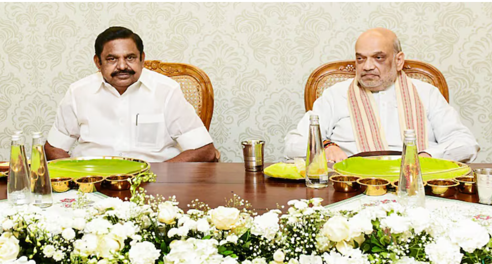
AIADMK-BJP seat-sharing talks to be finalised soon, says Edappadi K Palaniswami after Amit Shah meet
AIADMK chief Edappadi K Palaniswami says seat-sharing talks with BJP are in final stages and will conclude within days ahead of Tamil Nadu 2026 elections.

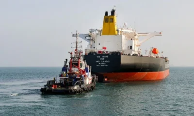
Russian oil tanker rerouted to India amid Middle East crisis, to reach Mangaluru on March 21

Ustaad Bhagat Singh review: Pawan Kalyan shines in high-action entertainer

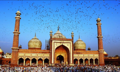
Eid 2026 in India may fall on March 20 or 21, moon sighting on March 19 to decide

Mamata Banerjee slams poll body over officials’ transfer, calls move unprecedented

PM Modi speaks to Qatar, France, Jordan, Oman and Malaysia leaders on Middle East tensions

Late-March western disturbance brings 1,000-km rain band across India, Pakistan and Afghanistan

Oppo K14 5G launched in India with 7000mAh battery, starts at Rs 17,999
Mamata Banerjee slams poll body over officials’ transfer, calls move unprecedented
PM Modi speaks to Qatar, France, Jordan, Oman and Malaysia leaders on Middle East tensions

AIADMK-BJP seat-sharing talks to be finalised soon, says Edappadi K Palaniswami after Amit Shah meet
Afghan Men Try To Hang With The Jet Engine Of The Aircraft in Kabul- Afghanistan News – Kabul News
Trending Top 10 News: 10000 Crore Fine on Flipkart, Apple to Launch Unique Feature, Hdfc Bank Job Ad
Trending Top 10 News: Nokia 6310, Apple sales, Bachpan ka Pyar Video Kid, Dainik Bhaskar IT Raid
Trending Top 10 News: Canada bans Indian flights, Rain in Delhi NCR, AIMIM Twitter hacked, Raj Kundra case
Trending Top 10 News: Shein India, Apple New Service, Pocket Oxygen, Oppo Launched New Phone
-
 Latest world news23 hours ago
Russian oil tanker rerouted to India amid Middle East crisis, to reach Mangaluru on March 21
-
 Entertainment22 hours ago
Ustaad Bhagat Singh review: Pawan Kalyan shines in high-action entertainer
-
 Festivals22 hours ago
Eid 2026 in India may fall on March 20 or 21, moon sighting on March 19 to decide
-
 India News9 hours ago
Mamata Banerjee slams poll body over officials’ transfer, calls move unprecedented
-
 Latest world news9 hours ago
PM Modi speaks to Qatar, France, Jordan, Oman and Malaysia leaders on Middle East tensions
-
 India News9 hours ago
AIADMK-BJP seat-sharing talks to be finalised soon, says Edappadi K Palaniswami after Amit Shah meet
-
 Gadgets8 hours ago
Oppo K14 5G launched in India with 7000mAh battery, starts at Rs 17,999
-
 India News3 hours ago
Late-March western disturbance brings 1,000-km rain band across India, Pakistan and Afghanistan